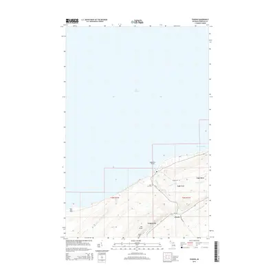
2014 Map of Phoenix
USGS Topo · Published 2014About this map
Eagle River and its surrounding Keweenaw County highlands are defined by the rugged shoreline of Lake Superior and the dramatic topography of the Cliff Range. This survey details the landscape near the northern tip of Michigan's Copper Country, where the Eagle River Falls mark the descent of the water toward the Eagle River Shoals. The small settlement of Phoenix sits at a critical junction of Us-41 and M-26, reflecting a pattern of development tied to the area's geological and mining history.
Find a feature on this map
24 named features on this map. Tap any name to fly to it.
Don’t see what you’re looking for? This feature index may not catch every label — zoom into the map to look around manually.
Map Details
Editions of this 2014 Phoenix Map
This is the sole edition of this map. No revisions or reprints were ever made.
Other maps of this area

1938 · Bruneau Creek
USGS Topo · 1:31,680

1940 · Central
USGS Topo · 1:31,680

1941 · Ahmeek
USGS Topo · 1:31,680

1941 · Mohawk
USGS Topo · 1:31,680

1946 · Phoenix
USGS Topo · 1:24,000

1946 · Bruneau Creek
USGS Topo · 1:24,000

1946 · Mohawk
USGS Topo · 1:24,000

1946 · Eagle Harbor
USGS Topo · 1:24,000

1946 · Ahmeek
USGS Topo · 1:24,000

1947 · Phoenix
USGS Topo · 1:24,000