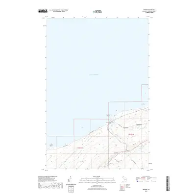
2019 Map of Phoenix
USGS Topo · Published 2019About this map
Eagle River serves as the focal point of this coastal Keweenaw County survey, where the river of the same name meets Lake Superior near the Keweenaw County Courthouse. The settlement pattern reflects the area's transition from early industrial roots to its role as a regional administrative and recreation hub. Traces of the region's copper-mining legacy appear in labels like Cliff Gem and the prominent Cliff Range, while the local infrastructure is defined by the Keweenaw State Trail following the former rail corridor inland to Phoenix. The topography is marked by sharp elevations such as Eagle Nest and the coastal features of Five Mile Point and Great Sand Bay. Numerous watercourses, including Silver Cr and the various branches of the Eagle River, carve through the terrain, culminating in the Eagle River Falls near the historic town site and the Eagle River Cem.
Find a feature on this map
27 named features on this map. Tap any name to fly to it.
Don’t see what you’re looking for? This feature index may not catch every label — zoom into the map to look around manually.
Map Details
Editions of this 2019 Phoenix Map
This is the sole edition of this map. No revisions or reprints were ever made.
Other maps of this area

1938 · Bruneau Creek
USGS Topo · 1:31,680

1940 · Central
USGS Topo · 1:31,680

1941 · Ahmeek
USGS Topo · 1:31,680

1941 · Mohawk
USGS Topo · 1:31,680

1946 · Phoenix
USGS Topo · 1:24,000

1946 · Bruneau Creek
USGS Topo · 1:24,000

1946 · Mohawk
USGS Topo · 1:24,000

1946 · Eagle Harbor
USGS Topo · 1:24,000

1946 · Ahmeek
USGS Topo · 1:24,000

1947 · Phoenix
USGS Topo · 1:24,000