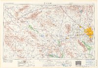
1971 Map of Phoenix
USGS Topo · Published 1971About this map
Phoenix anchors the eastern edge of this 1971 study, revealing a desert landscape in the midst of mid-century transformation. The sprawling suburban expansion of Glendale, Peoria, and the planned retirement communities of Sun City and Youngtown contrast sharply with the industrial and military presence at Luke Air Force Base. To the west, the arid Ran Egras Plain and Harquahala Plain are defined by the Atchison Topeka & Santa Fe railroad corridor, connecting small outposts like Wenden, Salome, and Aguila.
Find a feature on this map
91 named features on this map. Tap any name to fly to it.
Don’t see what you’re looking for? This feature index may not catch every label — zoom into the map to look around manually.
Map Details
Editions of this 1971 Phoenix Map
This is the sole edition of this map. No revisions or reprints were ever made.
Other maps of this area

1887 · Verde
USGS Topo · 1:250,000

1887 · Prescott
USGS Topo · 1:250,000

1892 · Verde
USGS Topo · 1:250,000

1892 · Prescott
USGS Topo · 1:250,000

1903 · Bradshaw Mountains
USGS Topo · 1:125,000

1903 · Congress
USGS Topo · 1:125,000

1904 · Camelback
USGS Topo · 1:62,500

1904 · Congress
USGS Topo · 1:125,000

1906 · Camelsback
USGS Topo · 1:62,500

1911 · Parker
USGS Topo · 1:125,000