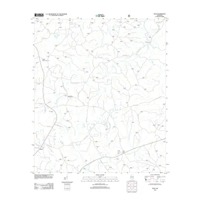
2012 Map of Piave
USGS Topo · Published 2012About this map
Smithtown and Piave anchor this rural Mississippi landscape, defined by a dense network of creek branches and family-named roads. The terrain is structured by drainages like Big Cr, Mason Cr, and the colorfully named Hell Hole Cr, while lookout towers such as Piney Woods Lookout Tower and Stony Lookout Tower suggest a history of managed timberland. For those tracing family history, the map preserves many specific local identifiers, from Henderson Cem to roads named for early residents, including T R Dunnam Rd and Frank Smith Rd. The placement of Patricks Bridge over Little Cr and the presence of scattered rural routes like Smithtown Chicora Rd reflect the enduring agricultural and forestry-based settlement patterns of Wayne County in the early 21st century.
Find a feature on this map
47 named features on this map. Tap any name to fly to it.
Don’t see what you’re looking for? This feature index may not catch every label — zoom into the map to look around manually.
Map Details
Editions of this 2012 Piave Map
This is the sole edition of this map. No revisions or reprints were ever made.
Other maps of this area

1953 · Hattiesburg
USGS Topo · 1:250,000

1958 · Hattiesburg
USGS Topo · 1:250,000

1963 · Brewer
USGS Topo · 1:24,000

1964 · Knobtown
USGS Topo · 1:24,000

1964 · Clark
USGS Topo · 1:24,000

1964 · Clara
USGS Topo · 1:24,000

1964 · Mulberry
USGS Topo · 1:24,000

1964 · Buckatunna
USGS Topo · 1:24,000

1964 · Avera
USGS Topo · 1:24,000

1964 · Piave
USGS Topo · 1:24,000