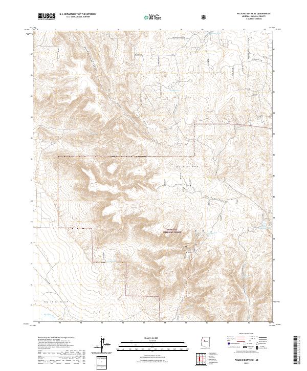
2021 Map of Picacho Butte SE
USGS Topo · Published 2021About this map
Prescott National Forest dominates the southern landscape of this Yavapai County region, where the high plateau of Big Black Mesa drops toward the broad Big Chino Valley. This area is defined by a critical network of water catchments and drainage systems, essential for ranching and wildlife in the arid Arizona interior. Named features such as Red Hat Tank, Mexican Tank, and Indian Tank dot the topography, while seasonal water sources like Storm Seep and Pool Seep are found tucked into the draws. The terrain is deeply incised by several prominent geological features, including Butcher Knife Canyon and Limestone Canyon, which channel runoff toward the Big Chino Wash in the southwest. A network of rural ranch roads, including W Rocky Rd and Howling Wolf Rd, provides access across the township lines of T20N and T19N.
Find a feature on this map
36 named features on this map. Tap any name to fly to it.
Don’t see what you’re looking for? This feature index may not catch every label — zoom into the map to look around manually.
Map Details
Editions of this 2021 Picacho Butte SE Map
This is the sole edition of this map. No revisions or reprints were ever made.
Other maps of this area

1886 · Chino
USGS Topo · 1:250,000

1887 · Prescott
USGS Topo · 1:250,000

1891 · Chino
USGS Topo · 1:250,000

1892 · Prescott
USGS Topo · 1:250,000

1905 · Jerome
USGS Topo · 1:125,000

1922 · Williams
USGS Topo · 1:125,000

1947 · Ash Fork
USGS Topo · 1:62,500

1947 · Simmons
USGS Topo · 1:62,500

1947 · Picacho Butte
USGS Topo · 1:62,500

1947 · Paulden
USGS Topo · 1:62,500