
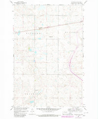
1959 Map of Pickardville
USGS Topo · Published 1960About this map
Pickardville serves as the primary settlement hub in this part of Sheridan County, situated along the Northern Pacific railroad line. The landscape is defined by the prairie pothole region's characteristic numerous small depressions and basins, which dominate the townships of Pickard, McClusky, and Edgemont. This 1959 survey was produced as part of the Department of the Interior's Missouri River Basin development program, illustrating the rural infrastructure of the era. Evidence of early twentieth-century education and community organization is preserved through the location of School No 1, which stands as a lone landmark in the southern reaches of the map. The alignment of the railroad through the northern section underscores its role in connecting these central North Dakota farming communities to broader markets.
Find a feature on this map
6 named features on this map. Tap any name to fly to it.
Don’t see what you’re looking for? This feature index may not catch every label — zoom into the map to look around manually.
Map Details
Editions of this 1959 Pickardville Map
2 editions found
Other maps of this area

1945 · Pelican Lake
USGS Topo · 1:62,500

1947 · Pelican Lake
USGS Topo · 1:62,500

1947 · Lincoln Valley
USGS Topo · 1:62,500

1954 · McClusky
USGS Topo · 1:250,000

1958 · McClusky
USGS Topo · 1:250,000

1959 · Mercer
USGS Topo · 1:24,000

1959 · Mercer SW
USGS Topo · 1:24,000

1959 · Mercer SE
USGS Topo · 1:24,000

1959 · McClusky
USGS Topo · 1:24,000

1960 · Horse Lake
USGS Topo · 1:24,000