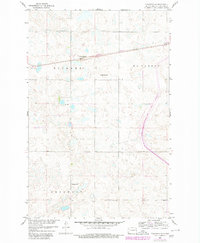
1959 Map of Pickardville
USGS Topo · Published 1980About this map
Pickardville sits along the rail line in Sheridan County, surrounded by a landscape of prairie depressions and low hills characteristic of the Missouri River Basin. This survey, updated with details from the late 1970s, captures the modernization of the rural landscape as a large Canal Under Construction cuts through the eastern sections of Mcclusky and Pickard townships. The local infrastructure of an earlier era remains visible, including the isolated School No 1 and various Gravel Pits that supported road and rail development.
Find a feature on this map
10 named features on this map. Tap any name to fly to it.
Don’t see what you’re looking for? This feature index may not catch every label — zoom into the map to look around manually.
Map Details
Editions of this 1959 Pickardville Map
2 editions found
Other maps of this area

1945 · Pelican Lake
USGS Topo · 1:62,500

1947 · Pelican Lake
USGS Topo · 1:62,500

1947 · Lincoln Valley
USGS Topo · 1:62,500

1954 · McClusky
USGS Topo · 1:250,000

1958 · McClusky
USGS Topo · 1:250,000

1959 · Pickardville
USGS Topo · 1:24,000

1959 · Mercer
USGS Topo · 1:24,000

1959 · Mercer SW
USGS Topo · 1:24,000

1959 · Mercer SE
USGS Topo · 1:24,000

1959 · McClusky
USGS Topo · 1:24,000