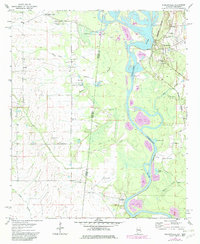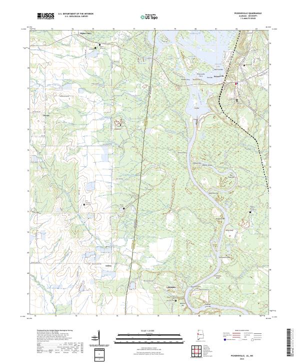
2024 Map of Pickensville
USGS Topo · Published 2024About this map
The Tombigbee River forms the central artery of this landscape, winding along the border between Alabama and Mississippi. This modern survey illustrates the river’s continued role in local geography, featuring numerous named navigation markers and bars such as Ivie Bar, Shylock Bar, and Ford Bar. The town of Pickensville remains a focal point on the eastern bank, while smaller communities and historical crossroads like Memphis, Aubrey, and Bigbee Valley dot the surrounding countryside.
Find a feature on this map
105 named features on this map. Tap any name to fly to it.
Don’t see what you’re looking for? This feature index may not catch every label — zoom into the map to look around manually.
Map Details
Editions of this 2024 Pickensville Map
This is the sole edition of this map. No revisions or reprints were ever made.
Historical Maps of Pickensville Through Time
6 maps found