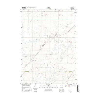
2015 Map of Pickett
USGS Topo · Published 2015About this map
Pickett and the surrounding rural landscape of Winnebago and Fond du Lac Counties are defined by a grid of agricultural land and scattered small settlements. This 2015 edition highlights the persistence of early community markers, particularly its numerous burial grounds including Liberty Prairie Cem, Tice Cem, Minckler Cem, and Zoar Cem. The topography is shaped by the drainage of Eightmile Cr and Sawyer Cr, which thread through the prairie toward the northwest and northeast. The area maintains a quiet, aviation-oriented character with both Williams Airport and Planeacres Airport serving the local vicinity. Small community centers like Zion, Elo, and Ring remain anchored at key road junctions, preserving the spatial arrangement of these Wisconsin townships as they have existed for generations.
Find a feature on this map
70 named features on this map. Tap any name to fly to it.
Don’t see what you’re looking for? This feature index may not catch every label — zoom into the map to look around manually.
Map Details
Editions of this 2015 Pickett Map
This is the sole edition of this map. No revisions or reprints were ever made.
Other maps of this area

1916 · Ripon
USGS Topo · 1:48,000

1918 · Ripon
USGS Topo · 1:62,500

1955 · Green Bay
USGS Topo · 1:250,000

1956 · Ripon
USGS Topo · 1:62,500

1956 · Rosendale
USGS Topo · 1:62,500

1957 · Madison
USGS Topo · 1:250,000

1960 · Madison
USGS Topo · 1:250,000

1961 · Oshkosh
USGS Topo · 1:24,000

1961 · Poy Sippi
USGS Topo · 1:62,500

1961 · Oshkosh
USGS Topo · 1:62,500