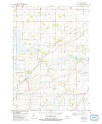
1980 Map of Pickett
USGS Topo · Published 1981About this map
The agricultural landscape of Winnebago and Fond du Lac counties is defined by a dense network of country roads and small farm-centered hamlets during the late 1970s. The Chicago Milwaukee St Paul and Pacific railroad cuts diagonally across the terrain, serving the settlement of Pickett and the smaller siding at Fisk. This survey reveals a community deeply rooted in its local institutions, evidenced by the numerous cemeteries such as Minckler Cem and Liberty Prairie Cem, alongside country schools like Plainview Sch. The presence of the Williams Landing Strip and Pfaffenroth Landing Strip suggests a reliance on private aviation for rural connectivity. Waterways like Eightmile Creek and Spring Brook meander through the townships of Utica and Rosendale, while small-scale industrial activity is represented by scattered Gravel Pits and a Substation near the Algoma township line.
Find a feature on this map
44 named features on this map. Tap any name to fly to it.
Don’t see what you’re looking for? This feature index may not catch every label — zoom into the map to look around manually.
Map Details
Editions of this 1980 Pickett Map
This is the sole edition of this map. No revisions or reprints were ever made.
Other maps of this area

1916 · Ripon
USGS Topo · 1:48,000

1918 · Ripon
USGS Topo · 1:62,500

1955 · Green Bay
USGS Topo · 1:250,000

1956 · Ripon
USGS Topo · 1:62,500

1956 · Rosendale
USGS Topo · 1:62,500

1957 · Madison
USGS Topo · 1:250,000

1960 · Madison
USGS Topo · 1:250,000

1961 · Oshkosh
USGS Topo · 1:24,000

1961 · Poy Sippi
USGS Topo · 1:62,500

1961 · Oshkosh
USGS Topo · 1:62,500