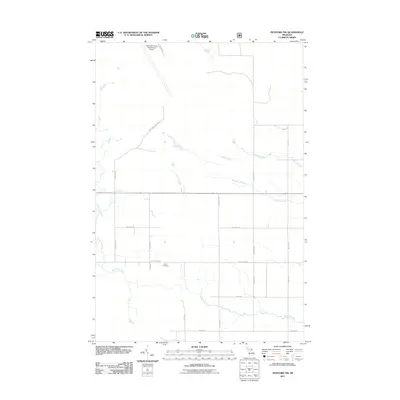
2011 Map of Pickford NW
USGS Topo · Published 2011About this map
The Munuscong River meanders through the southern reaches of this landscape, anchoring a rural grid of township roads and agricultural corridors. Central to the area's local history is the Cottle Cemetery, located just south of W Town Line Rd and E Town Line Rd. This section of the Upper Peninsula is defined by its drainage patterns, with Parker Creek and Sanderson Creek cutting through the eastern sections. In the northern corner, the Chippewa County International Airport marks a modern infrastructure hub, connected by the Mackinac Trail Spur. The map provides a look at the township's layout before further development, showing the transition from the river lowlands to the surveyed sections of S Mile Rd and S Hancock Rd.
Find a feature on this map
23 named features on this map. Tap any name to fly to it.
Don’t see what you’re looking for? This feature index may not catch every label — zoom into the map to look around manually.
Map Details
Editions of this 2011 Pickford NW Map
This is the sole edition of this map. No revisions or reprints were ever made.
Other maps of this area

1913 · Sault Sainte Marie
USGS Topo · 1:62,500

1931 · Pickford SE
USGS Topo · 1:31,680

1941 · Sault Sainte Marie
USGS Topo · 1:63,360

1941 · Brimley
USGS Topo · 1:63,360

1951 · Kinross
USGS Topo · 1:24,000

1951 · Dafter
USGS Topo · 1:24,000

1951 · Barbeau
USGS Topo · 1:24,000

1951 · Brimley
USGS Topo · 1:62,500

1951 · Sault Ste. Marie
USGS Topo · 1:62,500

1953 · Pickford NW
USGS Topo · 1:24,000
Featured Places
- Marquette Township, MI
- Kinross Township, MI
- Rudyard Township, MI
- Pickford Township, MI
- Chippewa County, MI