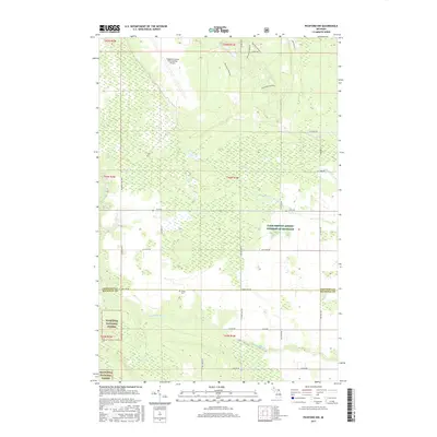
2017 Map of Pickford NW
USGS Topo · Published 2017About this map
Hiawatha National Forest dominates the southern landscape of this Upper Peninsula region, where the Munuscong River meanders eastward toward the St. Marys River system. This 2017 survey details a transition from the industrial and transportation hub at the Chippewa County International Airport in the north to a more structured agricultural and forested interior. Local history and genealogy interest is anchored by the Cottle Cem, located near W Town Line Rd on the border between Chippewa and Mackinac counties. The map reflects a landscape managed for both utility and recreation, featuring the Pine Bowl Pathway near the northern edge and significant land holdings under the Farm Service Agency Interest of Michigan. Small waterways like Sanderson Cr and Parker Cr drain the central wetlands, crisscrossed by a grid of named rural routes including Mackinac Trl Spr.
Find a feature on this map
37 named features on this map. Tap any name to fly to it.
Don’t see what you’re looking for? This feature index may not catch every label — zoom into the map to look around manually.
Map Details
Editions of this 2017 Pickford NW Map
This is the sole edition of this map. No revisions or reprints were ever made.
Other maps of this area

1913 · Sault Sainte Marie
USGS Topo · 1:62,500

1931 · Pickford SE
USGS Topo · 1:31,680

1941 · Sault Sainte Marie
USGS Topo · 1:63,360

1941 · Brimley
USGS Topo · 1:63,360

1951 · Kinross
USGS Topo · 1:24,000

1951 · Dafter
USGS Topo · 1:24,000

1951 · Barbeau
USGS Topo · 1:24,000

1951 · Brimley
USGS Topo · 1:62,500

1951 · Sault Ste. Marie
USGS Topo · 1:62,500

1953 · Pickford NW
USGS Topo · 1:24,000
Featured Places
- Marquette Township, MI
- Kinross Township, MI
- Rudyard Township, MI
- Pickford Township, MI
- Chippewa County, MI