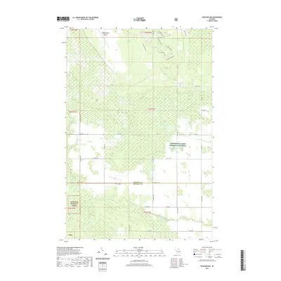
2019 Map of Pickford NW
USGS Topo · Published 2019About this map
Hiawatha National Forest dominates the southwestern portion of this landscape, marking the transition between the managed timberlands of the Upper Peninsula and the agricultural plains to the east. The terrain is defined by a dense network of wetlands and small waterways, including Parker Cr and Sanderson Cr, which feed into the meandering Munuscong River near the southern boundary. This area serves as a vital corridor for both modern infrastructure and recreational use, featuring the Chippewa County International Airport at the northern edge and the winding Pine Bowl Pathway through the central woods.
Find a feature on this map
31 named features on this map. Tap any name to fly to it.
Don’t see what you’re looking for? This feature index may not catch every label — zoom into the map to look around manually.
Map Details
Editions of this 2019 Pickford NW Map
This is the sole edition of this map. No revisions or reprints were ever made.
Other maps of this area

1913 · Sault Sainte Marie
USGS Topo · 1:62,500

1931 · Pickford SE
USGS Topo · 1:31,680

1941 · Sault Sainte Marie
USGS Topo · 1:63,360

1941 · Brimley
USGS Topo · 1:63,360

1951 · Kinross
USGS Topo · 1:24,000

1951 · Dafter
USGS Topo · 1:24,000

1951 · Barbeau
USGS Topo · 1:24,000

1951 · Brimley
USGS Topo · 1:62,500

1951 · Sault Ste. Marie
USGS Topo · 1:62,500

1953 · Pickford NW
USGS Topo · 1:24,000
Featured Places
- Marquette Township, MI
- Kinross Township, MI
- Rudyard Township, MI
- Pickford Township, MI
- Chippewa County, MI