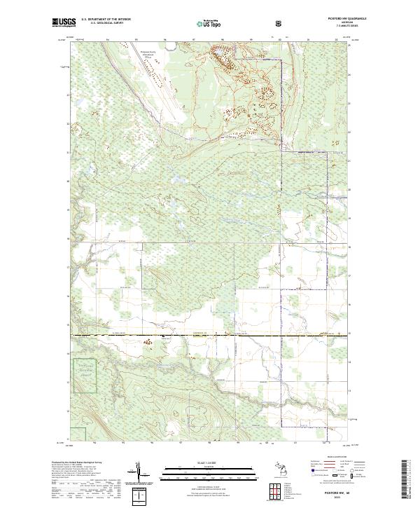
2023 Map of Pickford NW
USGS Topo · Published 2023About this map
Chippewa County International Airport dominates the northern edge of this territory, where the infrastructure of the Upper Peninsula meets the sprawling woods and wetlands of the Hiawatha National Forest. This landscape is defined by its transition from the managed lands of the Farm Service Agency Interest of Michigan to the dense, low-lying drainage basins of the Munuscong River. The terrain is etched by a intricate network of recreational paths, including the Kinross Motorcycle Trl and Pine Bowl Pathway Trl, which navigate the rises between Sanderson Creek and Parker Creek. Local history is anchored by the Cottle Cem on W Town Line Rd, a marker of earlier settlement along the boundary between Chippewa and Mackinac counties. The map reflects a modern balance of public forest management, aviation, and rural road networks like W M 48.
Find a feature on this map
41 named features on this map. Tap any name to fly to it.
Don’t see what you’re looking for? This feature index may not catch every label — zoom into the map to look around manually.
Map Details
Editions of this 2023 Pickford NW Map
This is the sole edition of this map. No revisions or reprints were ever made.
Other maps of this area

1913 · Sault Sainte Marie
USGS Topo · 1:62,500

1931 · Pickford SE
USGS Topo · 1:31,680

1941 · Sault Sainte Marie
USGS Topo · 1:63,360

1941 · Brimley
USGS Topo · 1:63,360

1951 · Kinross
USGS Topo · 1:24,000

1951 · Dafter
USGS Topo · 1:24,000

1951 · Barbeau
USGS Topo · 1:24,000

1951 · Brimley
USGS Topo · 1:62,500

1951 · Sault Ste. Marie
USGS Topo · 1:62,500

1953 · Pickford NW
USGS Topo · 1:24,000
Featured Places
- Marquette Township, MI
- Kinross Township, MI
- Pickford Township, MI
- Rudyard Township, MI
- Chippewa County, MI