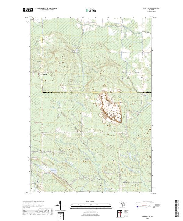
2023 Map of Pickford SE
USGS Topo · Published 2023About this map
The boundary between Chippewa Co and Mackinac Co bisects this northern Michigan landscape, where the settlement of Rockview sits along the Meridian Rd corridor. The geography is defined by a dense network of watercourses, including the East Branch Munuscong River in the northeast and McKay Creek winding through the central township. This modern survey reflects a region primarily organized by the Public Land Survey System, with roads like E Bishop Rd and W State Ave following the section lines. Local history is anchored at the Hannah Cem near the eastern margin. Further south, the terrain softens into the wetlands surrounding Leach Lake and Mud Lake, where smaller tracks like E Sherlund Ln and Up47 Trl provide access to the interior. The map illustrates how current infrastructure, such as E M 48, continues to follow the historic township and range divisions established during early settlement.
Find a feature on this map
44 named features on this map. Tap any name to fly to it.
Don’t see what you’re looking for? This feature index may not catch every label — zoom into the map to look around manually.
Map Details
Editions of this 2023 Pickford SE Map
This is the sole edition of this map. No revisions or reprints were ever made.
Other maps of this area

1931 · Pickford SE
USGS Topo · 1:31,680

1953 · Munuscong
USGS Topo · 1:24,000

1953 · Pickford NW
USGS Topo · 1:24,000
1953 · Pickford
USGS Topo · 1:24,000

1954 · Sault Sainte Marie
USGS Topo · 1:250,000

1955 · Cheboygan
USGS Topo · 1:250,000

1956 · Sault Sainte Marie
USGS Topo · 1:250,000

1957 · Sault Sainte Marie
USGS Topo · 1:250,000

1958 · Cheboygan
USGS Topo · 1:250,000

1958 · Sault Sainte Marie
USGS Topo · 1:250,000