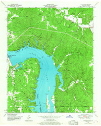
1949 Map of Pickwick
USGS Topo · Published 1967About this map
Pickwick Landing Dam dominates the landscape where the Tennessee River crosses the state line from Tennessee into Alabama. This 1949 survey by the Tennessee Valley Authority and Geological Survey illustrates the extensive impoundment of Pickwick Lake, which inundated former riverfront terrain while creating new opportunities for recreation and utility. Local life is anchored by several rural landmarks, including Pickwick Village, which served as the hub for dam operations, and the small settlement of Pyburns to the north.
Find a feature on this map
112 named features on this map. Tap any name to fly to it.
Don’t see what you’re looking for? This feature index may not catch every label — zoom into the map to look around manually.
Map Details
Editions of this 1949 Pickwick Map
This is the sole edition of this map. No revisions or reprints were ever made.
Other maps of this area

1911 · Iuka
USGS Topo · 1:48,000

1914 · Iuka
USGS Topo · 1:62,500

1935 · Doskie
USGS Topo · 1:24,000

1936 · Savannah
USGS Topo · 1:24,000

1936 · Wolf Pit Ridge
USGS Topo · 1:24,000

1936 · Waterloo
USGS Topo · 1:24,000

1936 · Counce
USGS Topo · 1:24,000

1936 · Shaws
USGS Topo · 1:24,000

1936 · Pickwick
USGS Topo · 1:24,000

1936 · Lowryville
USGS Topo · 1:24,000