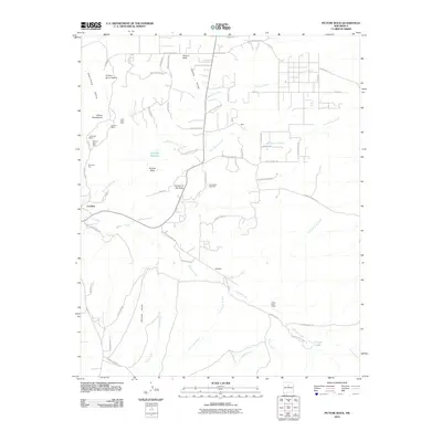
2010 Map of Picture Rock
USGS Topo · Published 2010About this map
The Cerrillos Hills dominate this section of Santa Fe County, revealing a landscape defined by its long-standing relationship with mining and the high desert climate. In the western reaches, the historic mining district is clearly visible through numerous workings, including the storied Turquoise Mines, Mina Del Tiro, and the Franklin Mine. These sites sit near the settlement of Cerrillos, while to the southeast, the village of Galisteo anchors the valley where Galisteo Creek meets Cañada de la Cueva. The map traces a complex network of arroyos such as Arroyo Coyote and Gallina Arroyo, illustrating how water and topography have shaped travel and habitation in this arid region. From the distinctive landmark of Garden of the Gods to the high point of Mount Chalchihuitl, the topography provides a clear picture of the area's geological and industrial heritage.
Find a feature on this map
73 named features on this map. Tap any name to fly to it.
Don’t see what you’re looking for? This feature index may not catch every label — zoom into the map to look around manually.
Map Details
Editions of this 2010 Picture Rock Map
This is the sole edition of this map. No revisions or reprints were ever made.
Other maps of this area

1889 · Santa Fe
USGS Topo · 1:125,000

1892 · San Pedro
USGS Topo · 1:125,000

1892 · Santa Clara
USGS Topo · 1:125,000

1894 · Santa Fe
USGS Topo · 1:125,000

1894 · Lamy
USGS Topo · 1:125,000

1951 · Turquoise Hill
USGS Topo · 1:24,000

1952 · Turquoise Hill
USGS Topo · 1:24,000

1952 · Seton Village
USGS Topo · 1:24,000

1953 · Tetilla Peak
USGS Topo · 1:24,000

1953 · Agua Fria
USGS Topo · 1:62,500