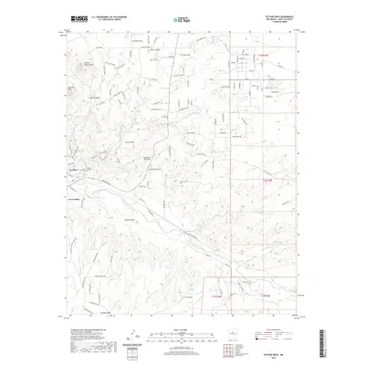
2020 Map of Picture Rock
USGS Topo · Published 2020About this map
Cerrillos and Los Cerrillos anchor the southwestern portion of this Santa Fe County landscape, where the high desert terrain is cut by the winding course of Galisteo Creek. The map documents a complex network of arroyos and canyons, including the significant San Marcos Arroyo and Cañada de la Cueva, which define the drainage patterns of the region. Near the settlement of Cerrillos, the Cerrillos Protestant Cem and the Cerrillos Reservoir provide evidence of long-standing community infrastructure.
Find a feature on this map
129 named features on this map. Tap any name to fly to it.
Don’t see what you’re looking for? This feature index may not catch every label — zoom into the map to look around manually.
Map Details
Editions of this 2020 Picture Rock Map
This is the sole edition of this map. No revisions or reprints were ever made.
Other maps of this area

1889 · Santa Fe
USGS Topo · 1:125,000

1892 · San Pedro
USGS Topo · 1:125,000

1892 · Santa Clara
USGS Topo · 1:125,000

1894 · Santa Fe
USGS Topo · 1:125,000

1894 · Lamy
USGS Topo · 1:125,000

1951 · Turquoise Hill
USGS Topo · 1:24,000

1952 · Turquoise Hill
USGS Topo · 1:24,000

1952 · Seton Village
USGS Topo · 1:24,000

1953 · Tetilla Peak
USGS Topo · 1:24,000

1953 · Agua Fria
USGS Topo · 1:62,500