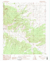
1990 Map of Picture Rock
USGS Topo · Published 1990About this map
San Marcos Pueblo occupies a central position in this high-desert landscape, reflecting the long-standing human presence in the region south of Santa Fe. The terrain is defined by the Cerrillos Hills to the northwest, a cluster of peaks including Mount Chalchihuitl and El Cerro de la Cosena that are pockmarked with dozens of prospects and specialized mining sites like the Cash Entry Mine. This concentration of extraction points, alongside the Mina del Tierra, indicates the area's significance for mineral wealth, likely spanning from indigenous turquoise mining to modern prospecting.
Find a feature on this map
42 named features on this map. Tap any name to fly to it.
Don’t see what you’re looking for? This feature index may not catch every label — zoom into the map to look around manually.
Map Details
Editions of this 1990 Picture Rock Map
This is the sole edition of this map. No revisions or reprints were ever made.
Other maps of this area

1889 · Santa Fe
USGS Topo · 1:125,000

1892 · San Pedro
USGS Topo · 1:125,000

1892 · Santa Clara
USGS Topo · 1:125,000

1894 · Santa Fe
USGS Topo · 1:125,000

1894 · Lamy
USGS Topo · 1:125,000

1951 · Turquoise Hill
USGS Topo · 1:24,000

1952 · Turquoise Hill
USGS Topo · 1:24,000

1952 · Seton Village
USGS Topo · 1:24,000

1953 · Tetilla Peak
USGS Topo · 1:24,000

1953 · Agua Fria
USGS Topo · 1:62,500