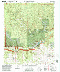
1997 Map of Piedmont Hollow
USGS Topo · Published 1999About this map
The Eleven Point River flows through the southern portion of this Ozark landscape, carving a corridor designated as the National Wild and Scenic River. This area within the Mark Twain National Forest is defined by its karst topography, where numerous water sources like Roaring Spring, Blowing Spring, and Cave Spring emerge from the limestone bluffs. The river provides recreational access at points such as the Cane Bluff Canoe Access, situated beneath the prominent Cane Bluff.
Find a feature on this map
53 named features on this map. Tap any name to fly to it.
Don’t see what you’re looking for? This feature index may not catch every label — zoom into the map to look around manually.
Map Details
Editions of this 1997 Piedmont Hollow Map
This is the sole edition of this map. No revisions or reprints were ever made.
Other maps of this area

1931 · Bandyville
USGS Topo · 1:48,000

1943 · Thayer
USGS Topo · 1:62,500

1944 · Couch
USGS Topo · 1:62,500

1944 · Birch Tree
USGS Topo · 1:62,500

1945 · Montier
USGS Topo · 1:62,500

1946 · Thayer
USGS Topo · 1:62,500

1946 · Couch
USGS Topo · 1:62,500

1948 · Montier
USGS Topo · 1:62,500

1948 · Birch Tree
USGS Topo · 1:62,500

1957 · Poplar Bluff
USGS Topo · 1:250,000