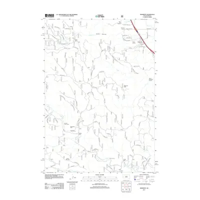
2012 Map of Piedmont
USGS Topo · Published 2012About this map
Piedmont sits at the edge of the Black Hills, marking a transition from the prairie into the uplifted canyons of South Dakota. The drainage patterns of Little Elk Cr and Boxelder Cr dominate the landscape, carving deep features like Little Elk Canyon and Chimney Canyon. The area serves as a significant recreational and transit corridor, with the Centennial Trail winding through the western hills and the Interstate 90 corridor facilitating the growth of settlements like Red Gate and White Gate. Local landmarks such as Steamboat Rock and Green Mountain provide prominent orientation points, while the Paradise Valley Airport and Dalton Campground highlight the mix of modern utility and forest-based leisure. This 2012 survey captures the intricate network of forest roads, including numerous branches of Piedmont Br and Erskine Gulch Br, which reveal the intensive management and accessibility of these wooded ridges.
Find a feature on this map
95 named features on this map. Tap any name to fly to it.
Don’t see what you’re looking for? This feature index may not catch every label — zoom into the map to look around manually.
Map Details
Editions of this 2012 Piedmont Map
This is the sole edition of this map. No revisions or reprints were ever made.
Other maps of this area

1893 · Rapid
USGS Topo · 1:125,000

1894 · Deadwood
USGS Topo · 1:125,000

1898 · Rapid
USGS Topo · 1:125,000

1899 · Sturgis
USGS Topo · 1:62,500

1901 · Deadwood
USGS Topo · 1:125,000

1903 · Rapid
USGS Topo · 1:125,000

1915 · Sturgis
USGS Topo · 1:62,500

1916 · Deadwood
USGS Topo · 1:125,000

1953 · Blackhawk
USGS Topo · 1:24,000

1953 · Piedmont
USGS Topo · 1:24,000