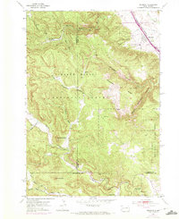
1958 Map of Piedmont
USGS Topo · Published 1980About this map
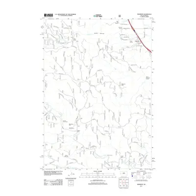
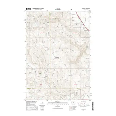
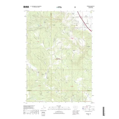
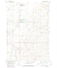
The town of Pierpont serves as the focal point for this survey of the northeastern South Dakota prairie, situated along the tracks of the Chicago Milwaukee St Paul and Pacific railroad. The landscape is characterized by its agricultural layout and small water bodies, notably Pierpont Lake and its associated Pierpont Lake Recreation Area. Rural educational life is visible through the presence of Union Prairie Sch and School No 180, which reflect the distributed settlement pattern common in the Missouri River Basin development era. The topography is dotted with numerous small potholes and basins, typical of the region's glaciated plains, while the small Gravel Pit indicates local mineral extraction used for maintaining the grid of county roads.
Find a feature on this map
10 named features on this map. Tap any name to fly to it.
Don’t see what you’re looking for? This feature index may not catch every label — zoom into the map to look around manually.
Map Details
Editions of this 1958 Piedmont Map
This is the sole edition of this map. No revisions or reprints were ever made.
Historical Maps of Summerset Through Time
6 maps found