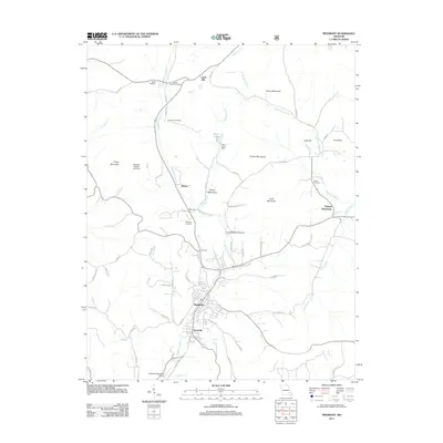
2011 Map of Piedmont
USGS Topo · Published 2011About this map
Piedmont serves as the central hub in this Missouri landscape, situated at the confluence of several vital watercourses including McKenzie Creek and Goose Creek. To the north, the small community of Gads Hill marks a point of historical interest, while the Virginia Settlement lies to the east along Clark Creek. The region is defined by a series of prominent elevations, such as Chlore Mountain, Grassy Mountain, and the Finleys Mountains, which dictate the winding paths of rural routes like Canyon Rd.
Find a feature on this map
62 named features on this map. Tap any name to fly to it.
Don’t see what you’re looking for? This feature index may not catch every label — zoom into the map to look around manually.
Map Details
Editions of this 2011 Piedmont Map
This is the sole edition of this map. No revisions or reprints were ever made.
Other maps of this area

1926 · Des Arc
USGS Topo · 1:62,500

1929 · Des Arc
USGS Topo · 1:62,500

1932 · Piedmont
USGS Topo · 1:62,500

1935 · Piedmont
USGS Topo · 1:62,500

1943 · Ellington
USGS Topo · 1:62,500

1943 · Lesterville
USGS Topo · 1:62,500

1945 · Ellington
USGS Topo · 1:62,500

1946 · Lesterville
USGS Topo · 1:62,500

1949 · Rolla
USGS Topo · 1:250,000

1953 · Rolla
USGS Topo · 1:250,000