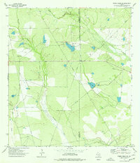
1974 Map of Piedra Creek NE
USGS Topo · Published 1977About this map
The arid brush country of South Texas is defined by its water management and resource extraction in this mid-1970s survey. Along the boundary between La Salle and McMullen Counties, the landscape is dominated by ranching operations and petroleum infrastructure. Cameron Ranch stands as the primary named settlement, served by a nearby Landing Strip and Radio Tower. The intermittent drainage of Quintania Creek and Green Branch is supplemented by several man-made stock tanks, including Piedra Tank, Coma Tank, and Wiley Tank, which are essential for livestock in this environment. Evidence of industrial activity is clear throughout the quadrangle, with numerous Oil Wells, a Gravel Pit, and a network of pipelines that cut across the terrain towards the Nueces drainage to the southeast. This document preserves the exact placement of these wells and ranch features before decades of subsequent energy development altered the surface.
Find a feature on this map
17 named features on this map. Tap any name to fly to it.
Don’t see what you’re looking for? This feature index may not catch every label — zoom into the map to look around manually.
Map Details
Editions of this 1974 Piedra Creek NE Map
This is the sole edition of this map. No revisions or reprints were ever made.
Other maps of this area

1930 · Tilden
USGS Topo · 1:62,500

1937 · Loma Alta
USGS Topo · 1:62,500

1942 · Fowlerton
USGS Topo · 1:62,500

1942 · Tilden
USGS Topo · 1:62,500

1953 · Crystal City
USGS Topo · 1:250,000

1955 · Crystal City
USGS Topo · 1:250,000

1956 · Piedra Creek
USGS Topo · 1:62,500

1956 · Fowlerton
USGS Topo · 1:62,500

1961 · Crystal City
USGS Topo · 1:250,000

1968 · Crystal City
USGS Topo · 1:250,000