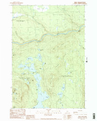
1989 Map of Pierce Pond
USGS Topo · Published 1989About this map
The Dead River carves a central path through this Somerset County wilderness, which is defined by an intricate network of interconnected water bodies. The expansive Pierce Pond serves as a focal point, linked to Upper Pierce Pond by The Thoroughfare. The landscape is framed by prominent peaks like Hurricane Mtn and Black Nubble, while the flow of Enchanted Stream and Salmon Stream underscores the watershed's complexity. The presence of multiple Gravel Pit labels indicates localized resource extraction within the vast timberlands. Mapping of boundaries like West Forks Plt and Bowtown highlights the historical land management divisions in this interior region of Maine. The geography reveals a classic North Woods environment where remote ponds like Lower Enchanted Pond and Kilgore Pond remain accessible only via unimproved roads and trails.
Find a feature on this map
40 named features on this map. Tap any name to fly to it.
Don’t see what you’re looking for? This feature index may not catch every label — zoom into the map to look around manually.
Map Details
Editions of this 1989 Pierce Pond Map
2 editions found
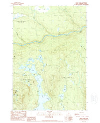
Other maps of this area

1903 · Bingham
USGS Topo · 1:62,500

1905 · Bingham
USGS Topo · 1:62,500

1905 · The Forks
USGS Topo · 1:62,500

1907 · The Forks
USGS Topo · 1:62,500

1925 · Pierce Pond
USGS Topo · 1:48,000

1927 · Pierce Pond
USGS Topo · 1:62,500

1928 · Dead River
USGS Topo · 1:62,500

1931 · Dead River
USGS Topo · 1:48,000

1944 · Dead River
USGS Topo · 1:62,500

1944 · Pierce Pond
USGS Topo · 1:62,500
Featured Places
- West Forks, ME
- Bowtown Township, ME
- Pierce Pond Township, ME
- Lower Enchanted Township, ME
- Somerset County, ME