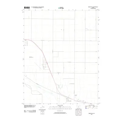
2009 Map of Pierceville
USGS Topo · Published 2009About this map
Pierceville sits along the northern banks of the Arkansas River, serving as a central point in this Finney County agricultural landscape. The 2009 survey shows a region defined by its flat terrain and highly organized grid of rural roads, including Mennonite Rd and S Sherman Rd. To the west, the Garden City Municipal Airport occupies a significant portion of the sheet, its expansive footprint contrasting with the traditional farm plots nearby. Local history is anchored at the Pierceville Cemetery, located just north of the town center. The transportation network is built for utility, with names like E Aerodrome Rd and E Air Base Rd reflecting the aviation influence on the local infrastructure. This map documents the intersection of rural life and modern aviation during the early twenty-first century.
Find a feature on this map
23 named features on this map. Tap any name to fly to it.
Don’t see what you’re looking for? This feature index may not catch every label — zoom into the map to look around manually.
Map Details
Editions of this 2009 Pierceville Map
This is the sole edition of this map. No revisions or reprints were ever made.
Other maps of this area

1896 · Garden
USGS Topo · 1:125,000

1944 · Tennis
USGS Topo · 1:62,500

1955 · Dodge City
USGS Topo · 1:250,000

1955 · Scott City
USGS Topo · 1:250,000

1958 · Dodge City
USGS Topo · 1:250,000

1958 · Scott City
USGS Topo · 1:250,000

1959 · Dodge City
USGS Topo · 1:250,000

1960 · Garden City East
USGS Topo · 1:24,000

1960 · Plymell
USGS Topo · 1:24,000

1967 · Pierceville SW
USGS Topo · 1:24,000