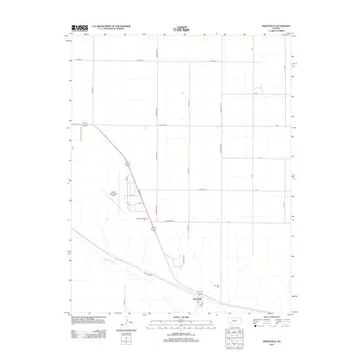
2012 Map of Pierceville
USGS Topo · Published 2012About this map
Pierceville sits in a high-plains landscape in Finney County, defined by the broad path of the Arkansas River and a rigid grid of rural section roads. The settlement is centered on a small cluster of streets including S Elm St, with the Pierceville Cem located just to the east. To the northwest, the Garden City Regional Airport occupies a significant portion of the plains, complemented by the nearby sports facility at The Airport Raceway. The landscape is partitioned by an extensive network of named roads such as E Pole Line Rd, N Mennonite Rd, and Mansfield Rd, which follow the township and range lines typical of Western Kansas. This 2012 survey illustrates the modern agricultural and transportation infrastructure of the region, where wide-open spaces are bridged by long-distance US routes and regional aviation hubs.
Find a feature on this map
26 named features on this map. Tap any name to fly to it.
Don’t see what you’re looking for? This feature index may not catch every label — zoom into the map to look around manually.
Map Details
Editions of this 2012 Pierceville Map
This is the sole edition of this map. No revisions or reprints were ever made.
Other maps of this area

1896 · Garden
USGS Topo · 1:125,000

1944 · Tennis
USGS Topo · 1:62,500

1955 · Dodge City
USGS Topo · 1:250,000

1955 · Scott City
USGS Topo · 1:250,000

1958 · Dodge City
USGS Topo · 1:250,000

1958 · Scott City
USGS Topo · 1:250,000

1959 · Dodge City
USGS Topo · 1:250,000

1960 · Garden City East
USGS Topo · 1:24,000

1960 · Plymell
USGS Topo · 1:24,000

1967 · Pierceville SW
USGS Topo · 1:24,000