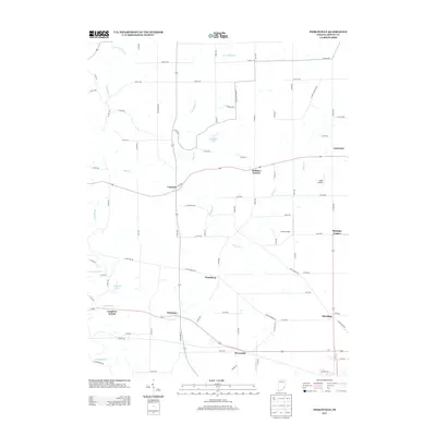
2013 Map of Pierceville
USGS Topo · Published 2013About this map
Pierceville and Old Milan anchor the southern reaches of this Ripley County landscape, where the rural character is defined by a dense grid of secondary roads and small, localized settlements. The drainage patterns of Laughery Cr and Ripley Cr carve through the terrain, supporting small impoundments like Broughton Lake and Paradise Lake. This area displays a classic Midwestern transition from historical hamlet centers to modern aviation interests, evidenced by the presence of Buell Airport and Lewis Airfield. These small airfields contrast with established junctions like Behlmer Corner and Stumpke Corner, which suggest the enduring importance of crossroads in the local community structure. Further west, Delaware and Laughery Switch mark significant points along the regional corridors, while more secluded locales like Lookout and Prattsburg provide insights into the dispersal of residents across the agricultural interior.
Find a feature on this map
45 named features on this map. Tap any name to fly to it.
Don’t see what you’re looking for? This feature index may not catch every label — zoom into the map to look around manually.
Map Details
Editions of this 2013 Pierceville Map
This is the sole edition of this map. No revisions or reprints were ever made.
Other maps of this area

1946 · Versailles
USGS Topo · 1:24,000

1946 · Milan
USGS Topo · 1:24,000

1946 · Pierceville
USGS Topo · 1:24,000

1946 · Batesville
USGS Topo · 1:24,000

1946 · Osgood
USGS Topo · 1:24,000

1946 · New Point
USGS Topo · 1:24,000

1953 · Cincinnati
USGS Topo · 1:250,000

1957 · Cincinnati
USGS Topo · 1:250,000

1958 · Spades
USGS Topo · 1:24,000

1958 · Sunman
USGS Topo · 1:24,000