
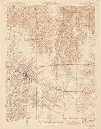
1946 Map of Batesville
USGS Topo · Published 1946About this map
Batesville and the surrounding borderlands of Franklin Co Ripley Co appear in high detail during the mid-1940s. The landscape is defined by the sharp contrast between the dissected hill country to the north and the flatter agricultural plains to the south. The New York Central railroad serves as the primary industrial corridor, anchoring the growth of Batesville and connecting the smaller hamlets of Morris and Spades.
Find a feature on this map
21 named features on this map. Tap any name to fly to it.
Don’t see what you’re looking for? This feature index may not catch every label — zoom into the map to look around manually.
Map Details
Editions of this 1946 Batesville Map
2 editions found
Other maps of this area

1946 · Pierceville
USGS Topo · 1:24,000

1946 · Osgood
USGS Topo · 1:24,000

1946 · New Point
USGS Topo · 1:24,000

1953 · Cincinnati
USGS Topo · 1:250,000

1956 · Metamora
USGS Topo · 1:24,000

1956 · Brookville
USGS Topo · 1:24,000

1957 · Cincinnati
USGS Topo · 1:250,000

1958 · Spades
USGS Topo · 1:24,000

1958 · Clarksburg
USGS Topo · 1:24,000

1958 · Sunman
USGS Topo · 1:24,000