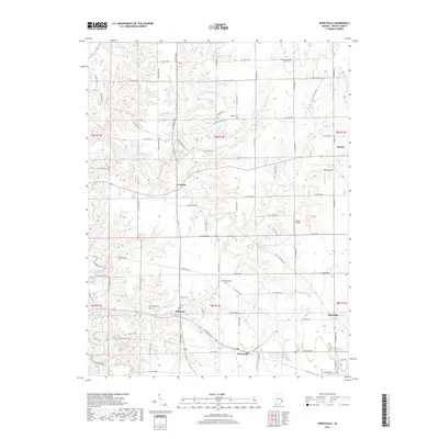
2019 Map of Pierceville
USGS Topo · Published 2019About this map
Pierceville and its surrounding hamlets in Ripley County define this landscape of rolling ridges and wooded creek bottoms. The terrain is deeply carved by the drainage systems of Laughery Creek and Ripley Creek, which dictate the winding paths of the local road network. Smaller crossroads like Lookout and Delaware appear alongside numerous rural burial grounds, including Little Memory Church Cem and Prattsburg Cem, which serve as vital markers for genealogical research in this part of southeastern Indiana. The presence of Buell Airport and Lewis Airfield indicates the continued utility of the flat ridge-top plateaus for small-scale aviation. While modern roads have largely overwritten older paths, the underlying cadastral survey lines of t8n r12e and adjacent townships still govern the orientation of homesteads and fields, preserving a layout established long before the 21st century.
Find a feature on this map
68 named features on this map. Tap any name to fly to it.
Don’t see what you’re looking for? This feature index may not catch every label — zoom into the map to look around manually.
Map Details
Editions of this 2019 Pierceville Map
This is the sole edition of this map. No revisions or reprints were ever made.
Other maps of this area

1946 · Versailles
USGS Topo · 1:24,000

1946 · Milan
USGS Topo · 1:24,000

1946 · Pierceville
USGS Topo · 1:24,000

1946 · Batesville
USGS Topo · 1:24,000

1946 · Osgood
USGS Topo · 1:24,000

1946 · New Point
USGS Topo · 1:24,000

1953 · Cincinnati
USGS Topo · 1:250,000

1957 · Cincinnati
USGS Topo · 1:250,000

1958 · Spades
USGS Topo · 1:24,000

1958 · Sunman
USGS Topo · 1:24,000