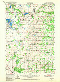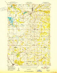
1950 Map of Pierz
USGS Topo · Published 1950About this map
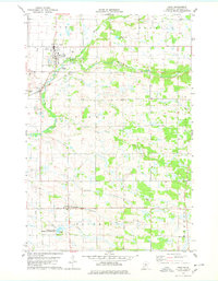
Pierz and Genola stand as central hubs in this mid-century portrait of Morrison and Benton Counties, where a dense network of country schools and rural churches defines the social geography of central Minnesota. The landscape is characterized by its organized township system, including Belle Prairie, Agram, and Buckman, each dotted with numerated schoolhouses such as School No 138 and School No 19. This period shows a transition in local commerce, with Rosemarks Store and Graham Town Hall serving as community anchors alongside smaller settlements like Skaja and Vawter.
Find a feature on this map
77 named features on this map. Tap any name to fly to it.
Don’t see what you’re looking for? This feature index may not catch every label — zoom into the map to look around manually.
Map Details
Editions of this 1950 Pierz Map
This is the sole edition of this map. No revisions or reprints were ever made.
Historical Maps of Rice Through Time
8 maps found