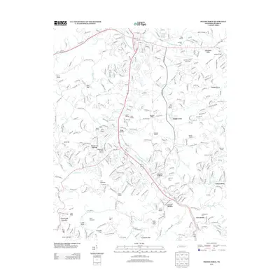
2013 Map of Pigeon Forge
USGS Topo · Published 2013About this map
Pigeon Forge and its surrounding communities are documented here as they appeared in 2013, showing the dense development along the W Prong Little Pigeon River and Middle Creek. The map details the transition from high-traffic commercial corridors like Dollywood Lane and Veterans Boulevard to the quiet, family-named hollows of the Great Smoky Mountains foothills. Genealogists and local historians can trace the geography of older settlements such as Henderson Springs, Reagantown, and Williamsburg, alongside the notable Mount Zion church.
Find a feature on this map
283 named features on this map. Tap any name to fly to it.
Don’t see what you’re looking for? This feature index may not catch every label — zoom into the map to look around manually.
Map Details
Editions of this 2013 Pigeon Forge Map
This is the sole edition of this map. No revisions or reprints were ever made.
Other maps of this area

1886 · Knoxville
USGS Topo · 1:125,000

1892 · Knoxville
USGS Topo · 1:125,000

1893 · Mt Guyot
USGS Topo · 1:125,000

1894 · Knoxville
USGS Topo · 1:125,000

1895 · Knoxville
USGS Topo · 1:125,000

1901 · Knoxville
USGS Topo · 1:125,000

1912 · Mt Guyot
USGS Topo · 1:125,000

1935 · English Mountain
USGS Topo · 1:48,000

1935 · Walden Creek
USGS Topo · 1:24,000

1935 · Richardson Cove
USGS Topo · 1:24,000
Featured Places
- Sevierville, TN
- Pigeon Forge, TN
- Little Cove, TN
- Henderson Springs, Pigeon Forge
- Pine Grove, Pigeon Forge