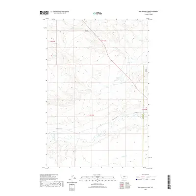
2020 Map of Pike Creek Hills West
USGS Topo · Published 2020About this map
Pike Creek Hills dominate the northeastern corner of this Central Montana landscape, where the high prairie begins to break into the drainage systems of the Missouri River watershed. The terrain is defined by a series of seasonal watercourses and coulees, most notably the wide valley of Flatwillow Cr which moves through the southern half of the quadrangle. This area on the Fergus and Petroleum County line reflects a classic ranching and grazing layout, with long-established routes like Upper Flatwillow Rd and Graves Rd following the natural contours of the land. The mapping of Kinnick Coulee in the north and various branches like Spring Cr and Pike Cr illustrates the complex hydrologic network essential for land use in this arid region, providing a clear view of the township and range survey system used to divide the territory into sections.
Find a feature on this map
14 named features on this map. Tap any name to fly to it.
Don’t see what you’re looking for? This feature index may not catch every label — zoom into the map to look around manually.
Map Details
Editions of this 2020 Pike Creek Hills West Map
This is the sole edition of this map. No revisions or reprints were ever made.
Other maps of this area

1954 · Roundup
USGS Topo · 1:250,000

1958 · Roundup
USGS Topo · 1:250,000

1986 · Tyler
USGS Topo · 1:24,000

1986 · Snoose Creek
USGS Topo · 1:24,000

1986 · Pender Coulee
USGS Topo · 1:24,000

1986 · Pike Creek Hills West
USGS Topo · 1:24,000

1986 · Lake Mason NE
USGS Topo · 1:24,000

1986 · Lake Mason NW
USGS Topo · 1:24,000

1986 · Pike Creek Hills East
USGS Topo · 1:24,000

1986 · Milk Springs
USGS Topo · 1:24,000