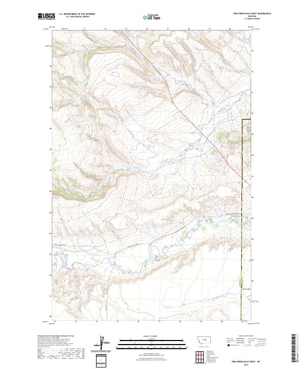
2024 Map of Pike Creek Hills West
USGS Topo · Published 2024About this map
Pike Creek Hills dominate the northern landscape of this central Montana quadrangle, where the headwaters of several drainage systems carve through the terrain. The topography is defined by the eastward flow of Pike Creek, Buck Creek, and Spring Creek, which eventually give way to the wider alluvial valley of Flatwillow Creek in the south. This region, straddling the border of Fergus and Petroleum counties, shows a sparse transportation network primarily consisting of Upper Flatwillow Rd and Graves Rd. The map illustrates the transition from the high ridges of the hills to the bottomlands near Little Wall Creek, providing a detailed look at the water sources and land divisions that have shaped ranching and land use in this part of the state.
Find a feature on this map
13 named features on this map. Tap any name to fly to it.
Don’t see what you’re looking for? This feature index may not catch every label — zoom into the map to look around manually.
Map Details
Editions of this 2024 Pike Creek Hills West Map
This is the sole edition of this map. No revisions or reprints were ever made.
Other maps of this area

1954 · Roundup
USGS Topo · 1:250,000

1958 · Roundup
USGS Topo · 1:250,000

1986 · Tyler
USGS Topo · 1:24,000

1986 · Snoose Creek
USGS Topo · 1:24,000

1986 · Pender Coulee
USGS Topo · 1:24,000

1986 · Pike Creek Hills West
USGS Topo · 1:24,000

1986 · Lake Mason NE
USGS Topo · 1:24,000

1986 · Lake Mason NW
USGS Topo · 1:24,000

1986 · Pike Creek Hills East
USGS Topo · 1:24,000

1986 · Milk Springs
USGS Topo · 1:24,000