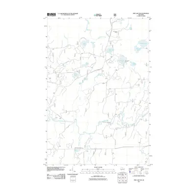
2011 Map of Pike Lake NW
USGS Topo · Published 2011About this map
The South Fork Flambeau River winds through this heavily forested portion of Price County, defining a landscape of complex glacial drainage and managed water resources. Private and public land use is evident in the southern reaches, where the Robert Sells 3WR814 Dam creates the Robert Sells Flowage 1, flanked by Elevenmile Creek and Clover Creek. The northern territory is characterized by a dense network of kettle lakes, including Patterson Lake, McDermott Lake, and Kabol Lake, providing a clear look at the region's recreational and aviation infrastructure near Springstead Airport.
Find a feature on this map
43 named features on this map. Tap any name to fly to it.
Don’t see what you’re looking for? This feature index may not catch every label — zoom into the map to look around manually.
Map Details
Editions of this 2011 Pike Lake NW Map
This is the sole edition of this map. No revisions or reprints were ever made.
Other maps of this area

1940 · Mercer
USGS Topo · 1:48,000

1940 · Butternut
USGS Topo · 1:48,000

1941 · Park Falls
USGS Topo · 1:48,000

1941 · Pike Lake
USGS Topo · 1:48,000

1942 · Pike Lake
USGS Topo · 1:48,000

1943 · Park Falls
USGS Topo · 1:48,000

1945 · Mercer
USGS Topo · 1:48,000

1947 · Park Falls
USGS Topo · 1:48,000

1947 · Butternut
USGS Topo · 1:48,000

1947 · Mercer
USGS Topo · 1:48,000