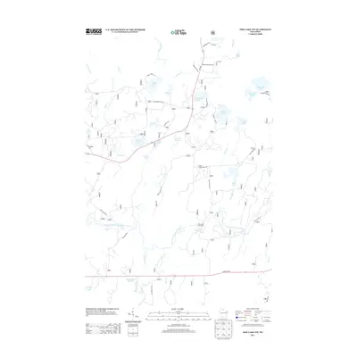
2013 Map of Pike Lake NW
USGS Topo · Published 2013About this map
The South Fork Flambeau River defines the lower half of this landscape, its course marked by landmarks like Little Cedar Rapids, Cedar Rapids, and Smith Rapids. This river-centric region in northern Wisconsin is characterized by an extensive system of natural lakes and managed waters, including Robert Sells Flowage 1 and Kabol Lake. Transportation is anchored by the corridor of State Hwy 70 and the north-south route past the Springstead Airport. The land is dotted with natural springs such as Newman Springs and Camp Four Springs, indicating a landscape rich in groundwater and drainage that feeds into the broader Beaver Creek and Byhre Creek systems. Public access points like the Smith River Campground show the intersection of the natural river environment with modern recreation, while a network of forest roads like Shady Knoll Rd and Blockhouse Lake Rd provides access to more remote water bodies such as Nettie B Lake and Thompson Lake.
Find a feature on this map
52 named features on this map. Tap any name to fly to it.
Don’t see what you’re looking for? This feature index may not catch every label — zoom into the map to look around manually.
Map Details
Editions of this 2013 Pike Lake NW Map
This is the sole edition of this map. No revisions or reprints were ever made.
Other maps of this area

1940 · Mercer
USGS Topo · 1:48,000

1940 · Butternut
USGS Topo · 1:48,000

1941 · Park Falls
USGS Topo · 1:48,000

1941 · Pike Lake
USGS Topo · 1:48,000

1942 · Pike Lake
USGS Topo · 1:48,000

1943 · Park Falls
USGS Topo · 1:48,000

1945 · Mercer
USGS Topo · 1:48,000

1947 · Park Falls
USGS Topo · 1:48,000

1947 · Butternut
USGS Topo · 1:48,000

1947 · Mercer
USGS Topo · 1:48,000