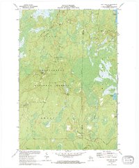
1971 Map of Pike Lake SE
USGS Topo · Published 1973About this map
Chequamegon National Forest dominates the landscape of north-central Wisconsin in this 1971 survey, showing a heavily wooded terrain shaped by an intricate network of wetlands and cold-water springs. The border between Price and Oneida Counties runs through the eastern portion of the map, where Squaw Lake and Bootjack Lake sit amidst a series of glacial depressions. The interior of the forest is marked by vital water sources such as Steverson Spring, Foulds Spring, and Willow Springs, which feed a labyrinth of drainage systems including Foulds Creek and Stevenson Creek. Evidence of fire management and forestry oversight is found at the Lookout Tower located in the western sector. This map provides a detailed view of the remote northern woods before modern development, recording a period when these secluded lakes and marshlands were primarily defined by their natural hydrology.
Find a feature on this map
21 named features on this map. Tap any name to fly to it.
Don’t see what you’re looking for? This feature index may not catch every label — zoom into the map to look around manually.
Map Details
Editions of this 1971 Pike Lake SE Map
2 editions found
Other maps of this area

1938 · Lac Du Flambeau
USGS Topo · 1:48,000

1939 · Lac Du Flambeau
USGS Topo · 1:48,000

1939 · Mc Cord
USGS Topo · 1:48,000

1941 · Pike Lake
USGS Topo · 1:48,000

1941 · Brantwood
USGS Topo · 1:48,000

1942 · Pike Lake
USGS Topo · 1:48,000

1943 · Brantwood
USGS Topo · 1:48,000

1946 · Lac Du Flambeau
USGS Topo · 1:48,000

1947 · Mc Cord
USGS Topo · 1:48,000

1950 · Pike Lake
USGS Topo · 1:48,000