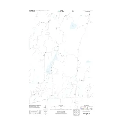
2013 Map of Pike Lake SW
USGS Topo · Published 2013About this map
Wilson Flowage dominates the central landscape of this Price County terrain, where the Elk River winds through a dense network of water bodies and tributary streams. This 2013 survey reveals a region defined by its hydrography, featuring major reservoirs like Riley Lake and smaller basins such as Mud Lake. The infrastructure is primarily composed of forest access roads and rural connectors, including Riley Lake Rd and Sheep Ranch Rd, which navigate the wetlands and ridges. Numerous creeks, such as Popple Creek, Spring Cr, and Chase Cr, carve through the land, illustrating the complex drainage patterns of the Wisconsin northwoods. The presence of Hardwood Ridge Ln and various forest service routes indicates the area's ongoing importance for timber management and outdoor recreation within the Chequamegon-Nicolet National Forest vicinity.
Find a feature on this map
54 named features on this map. Tap any name to fly to it.
Don’t see what you’re looking for? This feature index may not catch every label — zoom into the map to look around manually.
Map Details
Editions of this 2013 Pike Lake SW Map
This is the sole edition of this map. No revisions or reprints were ever made.
Other maps of this area

1941 · Park Falls
USGS Topo · 1:48,000

1941 · Pike Lake
USGS Topo · 1:48,000

1941 · Phillips
USGS Topo · 1:48,000

1941 · Brantwood
USGS Topo · 1:48,000

1942 · Pike Lake
USGS Topo · 1:48,000

1943 · Park Falls
USGS Topo · 1:48,000

1943 · Philliips
USGS Topo · 1:48,000

1943 · Brantwood
USGS Topo · 1:48,000

1947 · Park Falls
USGS Topo · 1:48,000

1950 · Pike Lake
USGS Topo · 1:48,000