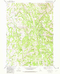
1978 Map of Pike Mountain
USGS Topo · Published 1982About this map
Sawtooth National Forest and the Minidoka Forest State Bird Sanctuary dominate this high-altitude landscape south of Twin Falls. The terrain is defined by the sharp divide of Deadline Ridge, where numerous forks of Rock Creek and Mountain View Creek have carved deep drainages like Wahlstrom Hollow and Bear Hollow. The map captures a high-desert recreation and service hub, featuring the Magic Mtn Ski Area and various organized camps including Kum Ba Yah Camp and Tawakani Camp.
Find a feature on this map
98 named features on this map. Tap any name to fly to it.
Don’t see what you’re looking for? This feature index may not catch every label — zoom into the map to look around manually.
Map Details
Editions of this 1978 Pike Mountain Map
2 editions found
Other maps of this area

1955 · Twin Falls
USGS Topo · 1:250,000

1958 · Twin Falls
USGS Topo · 1:250,000

1965 · Rams Horn Ridge
USGS Topo · 1:24,000

1965 · Grand View Peak
USGS Topo · 1:24,000

1965 · Mc Mullen Basin
USGS Topo · 1:24,000

1977 · Timber Butte
USGS Topo · 1:24,000

1977 · Big Creek Ranch
USGS Topo · 1:24,000

1977 · Mahogany Butte
USGS Topo · 1:24,000

1978 · Hopper Gulch
USGS Topo · 1:24,000
1978 · Pike Mountain
USGS Topo · 1:24,000