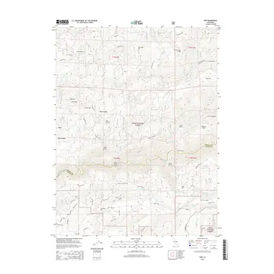
2015 Map of Pike
USGS Topo · Published 2015About this map
San Juan Ridge and the Middle Yuba River dominate this modern topographical record of the Sierra Nevada foothills, where the historic border of Sierra Co and Nevada Co follows the river's winding path. The map details a landscape deeply etched by the legacy of hydraulic mining and early mountain industry, featuring landmarks like the Footes Crossing Bridge and the site of Nelson Mill. Named ravines and flats, such as Trestle Ravine, Grizzly Gulch, and Chalk Flat, illustrate the intricate drainage system feeding into the Yuba. Small settlements and points of local interest, including Pike and Columbia Hill, are connected by a network of historic routes like Henness Pass Rd and Cruzon Grade Rd, while Tahoe National Forest lands encompass much of the surrounding timber and terrain.
Find a feature on this map
104 named features on this map. Tap any name to fly to it.
Don’t see what you’re looking for? This feature index may not catch every label — zoom into the map to look around manually.
Map Details
Editions of this 2015 Pike Map
This is the sole edition of this map. No revisions or reprints were ever made.
Other maps of this area

1888 · Smartsville
USGS Topo · 1:125,000

1888 · Bidwell Bar
USGS Topo · 1:125,000

1891 · Bidwell Bar
USGS Topo · 1:125,000

1891 · Downieville
USGS Topo · 1:125,000

1891 · Colfax
USGS Topo · 1:125,000

1891 · Smartsville
USGS Topo · 1:125,000

1892 · Smartsville
USGS Topo · 1:125,000

1892 · Colfax
USGS Topo · 1:125,000

1893 · Bidwell Bar
USGS Topo · 1:125,000

1893 · Downieville
USGS Topo · 1:125,000