Loading...
Loading map...1949 Map of Pike
USGS Topo · Published 1960About this map
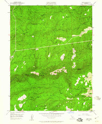
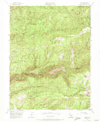
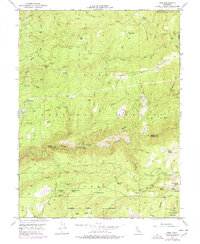
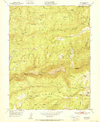
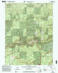
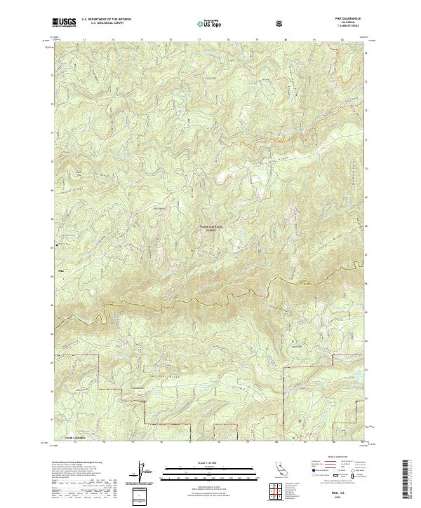
Pliocene Ridge and Grizzly Ridge dominate this rugged section of the Tahoe National Forest, documenting the landscape shortly after the era of intensive hydraulic mining. The map captures the divide between Sierra Co and Nevada Co along the Middle Yuba River, showing a network of historic mining operations such as the Omega Mine and the Alaska Mine (Site). Local history is grounded in small settlements and family ranch sites like Pike, Clerkins Ranch, and North Columbia.
Find a feature on this map
73 named features on this map. Tap any name to fly to it.
Don’t see what you’re looking for? This feature index may not catch every label — zoom into the map to look around manually.
Map Details
Date Portrayed1949
Date Published1960
PublisherU.S. Geological Survey
Map TypeTopographic
Scale1:24,000
Physical Dimensions22 x 26.8 inches
Editions of this 1949 Pike Map
3 editions found
Historical Maps of Nelson Mill Through Time
7 maps found
Featured Locations
Source Details
SourceU.S. Geological Survey
CopyrightPublic Domain