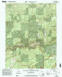
2000 Map of Pike
USGS Topo · Published 2003About this map
Pliocene Ridge serves as the high spine of this territory within the Tahoe National Forest, separating the drainages of Oregon Creek to the north from the Middle Yuba River to the south. The landscape is defined by its deep mining heritage, evident in the numerous sites scattered across the terrain. From the Alaska Mine and True Grit Mine to the Kate Hardy Mine near Kanaka Creek, the map documents an extensive industrial history of extraction.
Find a feature on this map
74 named features on this map. Tap any name to fly to it.
Don’t see what you’re looking for? This feature index may not catch every label — zoom into the map to look around manually.
Map Details
Editions of this 2000 Pike Map
This is the sole edition of this map. No revisions or reprints were ever made.
Other maps of this area

1888 · Smartsville
USGS Topo · 1:125,000

1888 · Bidwell Bar
USGS Topo · 1:125,000

1891 · Bidwell Bar
USGS Topo · 1:125,000

1891 · Downieville
USGS Topo · 1:125,000

1891 · Colfax
USGS Topo · 1:125,000

1891 · Smartsville
USGS Topo · 1:125,000

1892 · Smartsville
USGS Topo · 1:125,000

1892 · Colfax
USGS Topo · 1:125,000

1893 · Bidwell Bar
USGS Topo · 1:125,000

1893 · Downieville
USGS Topo · 1:125,000