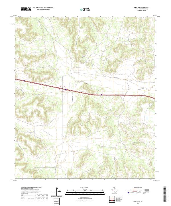
2022 Map of Pikes Peak
USGS Topo · Published 2022About this map
Pikes Peak rises as a distinct topographical landmark in this Crockett County landscape, centered among the ephemeral drainages that characterize this portion of the Edwards Plateau. The terrain is defined by the winding paths of Howard Draw, Pikes Peak Draw, and Eureka Draw, which carve intricate contour patterns through the arid upland. Modern infrastructure, including the straight-line corridor of Interstate 10, bisects the older network of ranch roads and county routes that historically connected the scattered holdings of this ranching country. Local access is maintained through a web of named thoroughfares such as Ranch Rd 2398, Clayton Rd, and Howard Draw Rd, illustrating the transition from traditional grazing lands to the contemporary transport corridor. This map offers a clear look at how drainage systems and modern highways converge in the West Texas interior.
Find a feature on this map
11 named features on this map. Tap any name to fly to it.
Don’t see what you’re looking for? This feature index may not catch every label — zoom into the map to look around manually.
Map Details
Editions of this 2022 Pikes Peak Map
This is the sole edition of this map. No revisions or reprints were ever made.
Other maps of this area

1929 · Sheffield
USGS Topo · 1:125,000

1954 · Sonora
USGS Topo · 1:250,000

1958 · Sonora
USGS Topo · 1:250,000

1967 · Owens Creek SE
USGS Topo · 1:24,000

1967 · Burnt Canyon
USGS Topo · 1:24,000

1967 · Pikes Peak
USGS Topo · 1:24,000
1967 · Schneeman Draw SW
USGS Topo · 1:24,000

1967 · Hunt Ranch
USGS Topo · 1:24,000

1967 · Bachelor Hill
USGS Topo · 1:24,000
1967 · Schneeman Draw SE
USGS Topo · 1:24,000