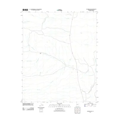
2011 Map of Pilgrim Wash
USGS Topo · Published 2011About this map
Big Sandy River defines the eastern edge of this Mohave County desert landscape, where a complex system of ephemeral washes and vital springs supported cattle ranching and early travel. The confluence of Cane Springs Wash and Trout Creek near the river bank highlights a topography dominated by drainage patterns like Pilgrim Wash and Moss Wash. Named water sources such as Cane Springs, Higgins Spring, and Hackberry Spring are sparse but critical landmarks in this arid environment. Transportation through the area is anchored by Co HWY 129 and a network of unpaved routes, including Upper Trout Creek Rd, which trace the natural contours of the land. This 2011 survey documents the enduring physical character of the Arizona backcountry, mapping the specific draws and springs that have long dictated human movement through the region.
Find a feature on this map
20 named features on this map. Tap any name to fly to it.
Don’t see what you’re looking for? This feature index may not catch every label — zoom into the map to look around manually.
Map Details
Editions of this 2011 Pilgrim Wash Map
This is the sole edition of this map. No revisions or reprints were ever made.
Other maps of this area

1886 · Diamond Creek
USGS Topo · 1:250,000

1892 · Diamond Creek
USGS Topo · 1:250,000

1923 · Signal
USGS Topo · 1:250,000

1942 · Signal
USGS Topo · 1:250,000

1948 · Williams
USGS Topo · 1:250,000

1950 · Prescott
USGS Topo · 1:250,000

1954 · Prescott
USGS Topo · 1:250,000

1954 · Williams
USGS Topo · 1:250,000

1956 · Williams
USGS Topo · 1:250,000

1958 · Prescott
USGS Topo · 1:250,000