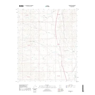
2018 Map of Pilgrim Wash
USGS Topo · Published 2018About this map
The Big Sandy River drainage system dominates this Mohave County landscape, where complex ephemeral washes and spring-fed points define the local geography. In the northern reaches, Moss Wash and Left Hand Moss Wash converge near the Cats Claw Trl, indicating a network of historical routes through the arid terrain. The map reveals a high concentration of water sources and crossings essential for cattle ranching, such as Big Pasture Spring and Higgins Spring, alongside named landforms like Bull Canyon and Cone Wash. Local transportation is marked by primitive roads like Odle Ranch Rd and Co Hwy 129, which trace the path of seasonal watercourses including Cane Springs Wash and Wagon Wheel Wash. The convergence of Trout Creek and Knight Creek in the east highlights the significance of these drainage basins to the regional topography.
Find a feature on this map
31 named features on this map. Tap any name to fly to it.
Don’t see what you’re looking for? This feature index may not catch every label — zoom into the map to look around manually.
Map Details
Editions of this 2018 Pilgrim Wash Map
This is the sole edition of this map. No revisions or reprints were ever made.
Other maps of this area

1886 · Diamond Creek
USGS Topo · 1:250,000

1892 · Diamond Creek
USGS Topo · 1:250,000

1923 · Signal
USGS Topo · 1:250,000

1942 · Signal
USGS Topo · 1:250,000

1948 · Williams
USGS Topo · 1:250,000

1950 · Prescott
USGS Topo · 1:250,000

1954 · Prescott
USGS Topo · 1:250,000

1954 · Williams
USGS Topo · 1:250,000

1956 · Williams
USGS Topo · 1:250,000

1958 · Prescott
USGS Topo · 1:250,000