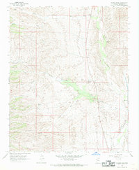
1967 Map of Pilgrim Wash
USGS Topo · Published 1969About this map
Desert water sources and remote ranching infrastructure define this arid corridor of Mohave County during the late 1960s. The landscape is oriented around dry watercourses like Pilgrim Wash and Cane Springs Wash, where scattered wells and springs provided essential support for livestock. A network of jeep trails winds through the varied terrain of Bull Canyon and the Hair Clipper ridge, connecting isolated points of interest such as the Wagon Wheel Well and Middle Moss Wash Well. This topography reflects the survival strategies of high-desert ranching before widespread modern development altered the region.
Find a feature on this map
30 named features on this map. Tap any name to fly to it.
Don’t see what you’re looking for? This feature index may not catch every label — zoom into the map to look around manually.
Map Details
Editions of this 1967 Pilgrim Wash Map
This is the sole edition of this map. No revisions or reprints were ever made.
Other maps of this area

1886 · Diamond Creek
USGS Topo · 1:250,000

1892 · Diamond Creek
USGS Topo · 1:250,000

1923 · Signal
USGS Topo · 1:250,000

1942 · Signal
USGS Topo · 1:250,000

1948 · Williams
USGS Topo · 1:250,000

1950 · Prescott
USGS Topo · 1:250,000

1954 · Prescott
USGS Topo · 1:250,000

1954 · Williams
USGS Topo · 1:250,000

1956 · Williams
USGS Topo · 1:250,000

1958 · Prescott
USGS Topo · 1:250,000