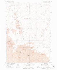
1972 Map of Pillar Butte
USGS Topo · Published 1977About this map
The Great Rift and the vast Wapi Lava Flow dominate this stark volcanic landscape along the boundary of Blaine Co and Power Co. This 1972 survey documents a geologic environment defined by basaltic vents and subterranean features rather than human settlement. The map reveals an intricate network of volcanic landmarks, including the prominent Pillar Butte and several notable cavernous formations such as Crystal Ice Cave, Creons Cave, and Lariat Cave.
Find a feature on this map
15 named features on this map. Tap any name to fly to it.
Don’t see what you’re looking for? This feature index may not catch every label — zoom into the map to look around manually.
Map Details
Editions of this 1972 Pillar Butte Map
This is the sole edition of this map. No revisions or reprints were ever made.
Other maps of this area

1954 · Pocatello
USGS Topo · 1:250,000

1955 · Idaho Falls
USGS Topo · 1:250,000

1958 · Idaho Falls
USGS Topo · 1:250,000

1958 · Pocatello
USGS Topo · 1:250,000

1972 · Schodde Well
USGS Topo · 1:24,000
1972 · Rattlesnake Butte
USGS Topo · 1:24,000

1972 · Bear Trap Cave
USGS Topo · 1:24,000

1972 · Mule Butte
USGS Topo · 1:24,000
1972 · Pillar Butte SE
USGS Topo · 1:24,000

1972 · Mosby Well
USGS Topo · 1:24,000