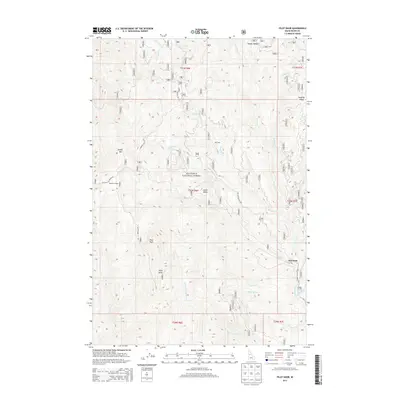
2013 Map of Pilot Knob
USGS Topo · Published 2013About this map
Newsome serves as a primary point of interest within this high-country landscape of the Nez Perce National Forest. The map documents a rugged terrain defined by significant peaks and ridges, including Pilot Knob, Pilot Rock, and Baldy Mtn. Local movement through the drainage basins of Newsome Creek and its many tributaries is facilitated by a network of forest roads and historic routes. Notable among these is the Old Elk City Wagon Rd, a legacy of the area's early transportation development. Isolated outposts such as Mountain House, Lytle Camp, and Pell Cabin are scattered across the quadrangle, illustrating the dispersed nature of habitation and resource management in this part of Idaho County. The intricate drainage network, featuring Sing Lee Creek and Sawmill Creek, highlights the complex topography that has shaped the area's logging and mining history.
Find a feature on this map
33 named features on this map. Tap any name to fly to it.
Don’t see what you’re looking for? This feature index may not catch every label — zoom into the map to look around manually.
Map Details
Editions of this 2013 Pilot Knob Map
This is the sole edition of this map. No revisions or reprints were ever made.
Other maps of this area

1924 · Weippe
USGS Topo · 1:125,000

1931 · Buffalo Hump
USGS Topo · 1:125,000

1934 · Buffalo Hump
USGS Topo · 1:125,000

1956 · Elk City
USGS Topo · 1:250,000

1956 · Hamilton
USGS Topo · 1:250,000

1959 · Hamilton
USGS Topo · 1:250,000

1960 · Elk City
USGS Topo · 1:250,000

1960 · Hamilton
USGS Topo · 1:250,000

1962 · Golden
USGS Topo · 1:24,000

1962 · Center Star Mtn
USGS Topo · 1:24,000