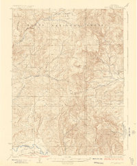
1925 Map of Pilot Knob
USGS Topo · Published 1925About this map
Routt National Forest dominates this high-country landscape in the early 1920s, showing a transition from timbered wilderness to a burgeoning extraction economy. Small settlements and specialized outposts like Elkhead and Gantts Cabin are scattered along the drainages of Elkhead Creek and the South Fork Elkhead Creek, while the presence of the Long Gulch School, Deep Creek School, and Wolf Creek School points to a distributed community of ranching and mining families.
Find a feature on this map
34 named features on this map. Tap any name to fly to it.
Don’t see what you’re looking for? This feature index may not catch every label — zoom into the map to look around manually.
Map Details
Editions of this 1925 Pilot Knob Map
2 editions found
Other maps of this area

1911 · Hahns Peak
USGS Topo · 1:125,000

1913 · Hahns Peak
USGS Topo · 1:125,000

1916 · Daton Peak
USGS Topo · 1:62,500

1920 · Daton Peak
USGS Topo · 1:62,500

1923 · Elkhead Creek
USGS Topo · 1:62,500

1923 · Pilot Knob
USGS Topo · 1:62,500

1924 · Elkhead Creek
USGS Topo · 1:62,500

1924 · Mt. Harris
USGS Topo · 1:48,000

1925 · Pilot Knob
USGS Topo · 1:62,500

1926 · Mount Harris
USGS Topo · 1:62,500