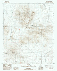
1987 Map of Pilot Knob
USGS Topo · Published 1987About this map
The Naval Weapons Center dominates this high-desert landscape in San Bernardino County, where restricted military use and remote terrain converge. The sheet is defined by the massive elevation of Robbers Mountain in the north and the namesake peak of Pilot Knob further south, creating a corridor of steep vertical relief. These peaks overlook a network of 4wd tracks that represent the only modern infrastructure in this arid environment.
Find a feature on this map
10 named features on this map. Tap any name to fly to it.
Don’t see what you’re looking for? This feature index may not catch every label — zoom into the map to look around manually.
Map Details
Editions of this 1987 Pilot Knob Map
This is the sole edition of this map. No revisions or reprints were ever made.
Other maps of this area

1915 · Searles Lake
USGS Topo · 1:250,000

1947 · Trona
USGS Topo · 1:250,000

1948 · Trona
USGS Topo · 1:250,000

1949 · Searles Lake
USGS Topo · 1:62,500

1950 · Searles Lake
USGS Topo · 1:62,500

1950 · Wingate Pass
USGS Topo · 1:62,500

1951 · Wingate Pass
USGS Topo · 1:62,500

1953 · Trona
USGS Topo · 1:250,000

1954 · Pilot Knob
USGS Topo · 1:62,500

1954 · Cuddeback Lake
USGS Topo · 1:62,500